

This summer, DPhil student Will Hartz joined a scientific expedition to the remote Norwegian island of Jan Mayen. In satellite imagery the island appears as a punctuation mark, adrift in the ocean. But this volcanic island is rooted in the bathymetric barrier that helps to define the circulation of the Greenland, Icelandic and Norwegian seas; it is an integral part of the ocean that surrounds it. And, lying 500 km east of central Greenland and 1,000 km west of Nordkapp, Norway, there is a lot of surrounding ocean.
Will and his team travelled to Jan Mayen from Ålesund, Norway, on a 49 foot sailboat—a five day journey at the mercy of the waves. But the weather smiled on the team, and they arrived at Jan Mayen in clement conditions.
Will’s role in the expedition was to conduct sampling of the snow, soil and water, to detect and measure contaminants.
“Having worked during my PhD on Svalbard collecting snow samples for PFAS and microplastics, I was invited to join the expedition to use the same sampling methods.”
Will was responsible for sampling for organic contaminants known as PFAS & PAHs, as well as microplastics.
PFAS: perfluoroalky and polyfluoroalkyl substances
PAHs: polycyclic aromatic hydrocarbons
Will explains that his aim was to sample for these substances across the island, with the goal of understanding the nature of local and long-range contaminant sources, and how these contaminants got to be where they were found.
Jan Mayen is so remote it offers an ideal location to understand the processes for the long range transport of contaminants to the Arctic. Of course, we cannot neglect natural and anthropogenic local sources that also might exist such as diesel generators at the station and or local volcanic activity.
However, the weather that had been so kind on their nautical transit was not to make it easy for them.
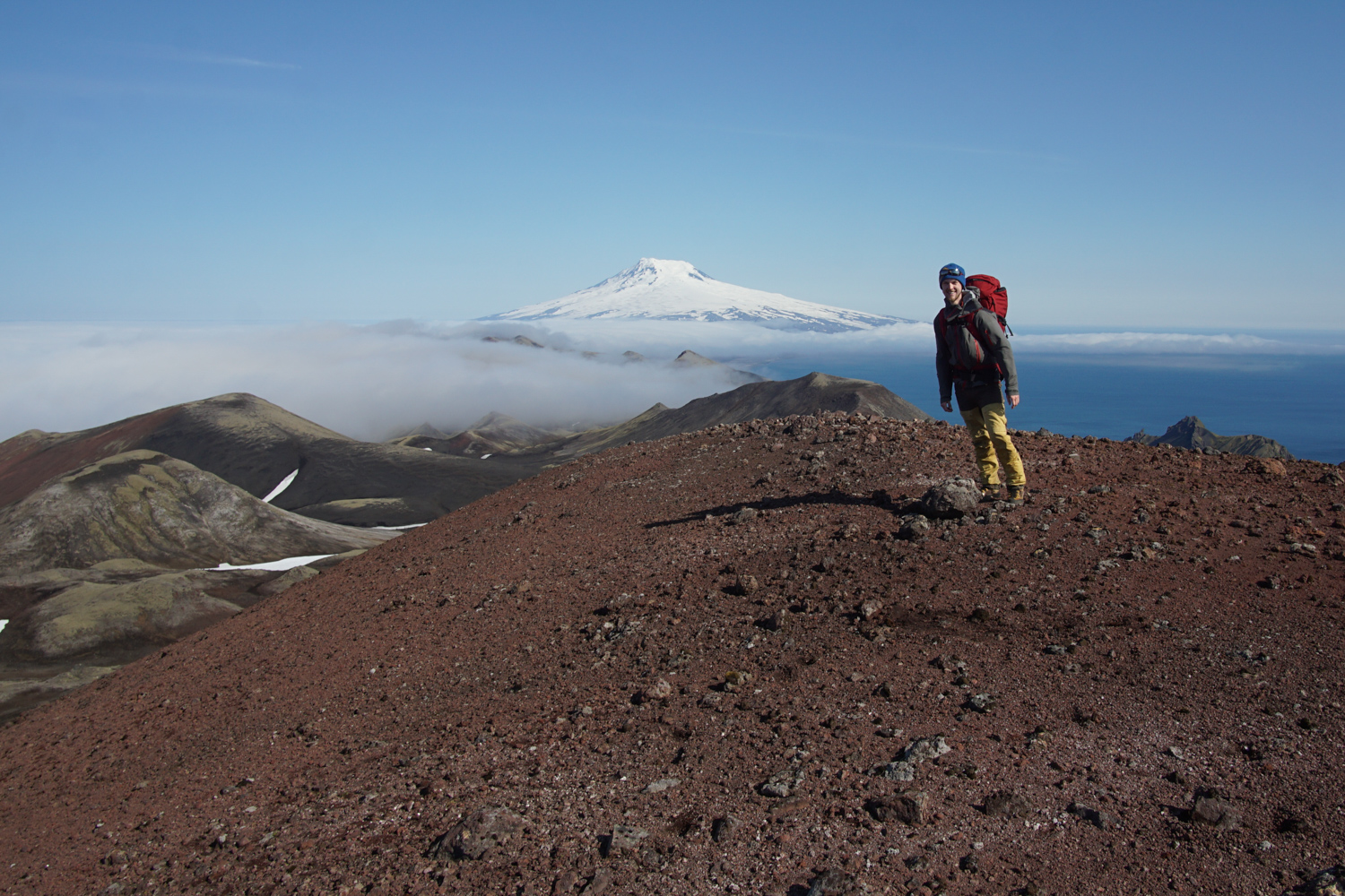
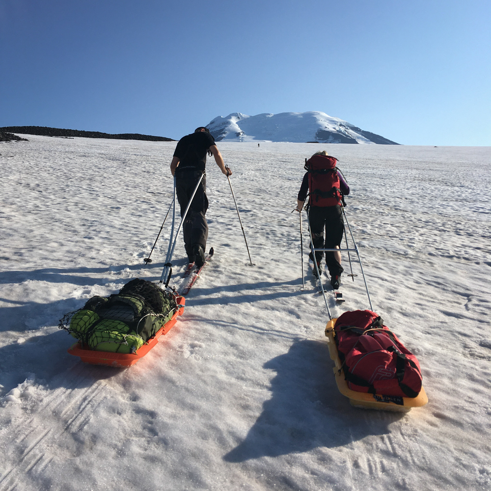
During the whole time we were there we only had two weather windows to go up the volcano, Beerenberg, to conduct sampling there. Since Beerenberg is so high, we had to leave the station very early in the morning and be out in the field for upwards of 15 hours at a time.
But the rewards for getting up onto Beerenberg, which dominates the island’s topography, were great.
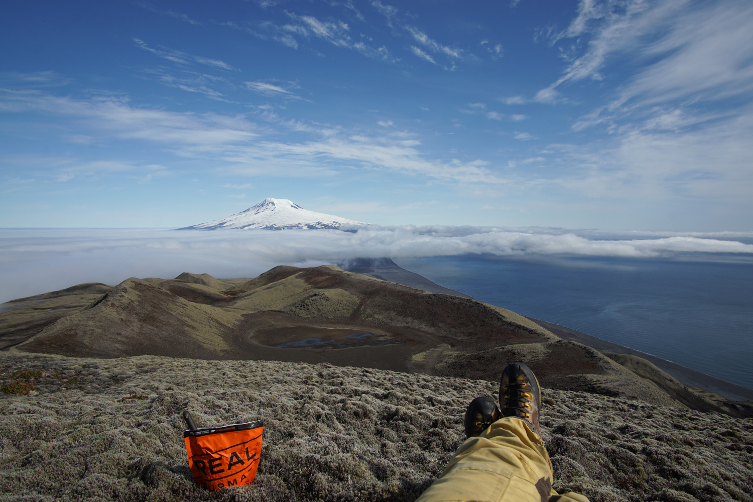
Standing on top of the volcano, looking down into the crater and south towards the rest of the island was unique. It is the only high point in the north of island and the view is like being in a plane! Of course, skiing in the middle of summer on an Arctic volcano is also unforgettable.
And despite the limited weather windows, Will and his colleagues collected a lot of material.
In the end our samples were on two pallets and weighed 365kg—we have a lot of analysis to do!
But it seems that the early signs have allowed a hypothesis to form.
We think that the persistent summer temperature inversion that exists on Beerenberg might be able to explain a large part of the distribution of contaminants we observe on Beerenberg.
We’ll have to keep tuned for more, as Will and his colleagues aim to explain the extent to which—and means by which—this remote island comes under the influence of anthropogenic pollution.
Will Hartz is a DPhil student on the NERC DTP in Environmental Research, based in Earth Sciences, and is a guest PhD student at the Arctic Geology department at the University Centre in Svalbard.